Well, just a little over a month after my hike along the Sawtooth Trail in the Tahoe National Forest on 4th of July weekend, I broke out my hiking shoes, and hit up another trail in the Tahoe National Forest!! The particular trail I hiked was the Mt. Judah Loop Trail, which is in the Donner Summit region of the forest, right near the Sugar Bowl Ski Resort. I first heard about the trail in one of my hiking books that I refer to frequently: “Lake Tahoe: Must-Do Hikes for Everyone”. It’s definitely a handy guide to have around if you’re looking for hikes to frequent in the Lake Tahoe region. Getting to the trailhead is a small challenge, as there is no marked road you turn onto. In fact, if you’re not paying attention, you could easily miss your turn off, like I almost did!! If you’re coming from the Soda Springs exit off Interstate 80, you’ll drive down Donner Pass Road toward the Summit and Truckee. Right before you reach the summit, you’ll see a building on the right hand side known as the Alpine Skills International. That’s where you’ll make your right turn, and look for the Pacific Crest Trail signs, which will guide you to make a left turn. Because parking is quite limited, you basically have to park on the side of the road. Be careful you don’t block driveways, as there are a few houses on the road. Once you find the trailhead, you’re good to go! Let’s take a look:

The beginnings of my hike. A view of Donner Summit. The trail starts out rocky, with a few switchbacks. But the switchbacks aren’t too terrible to navigate!

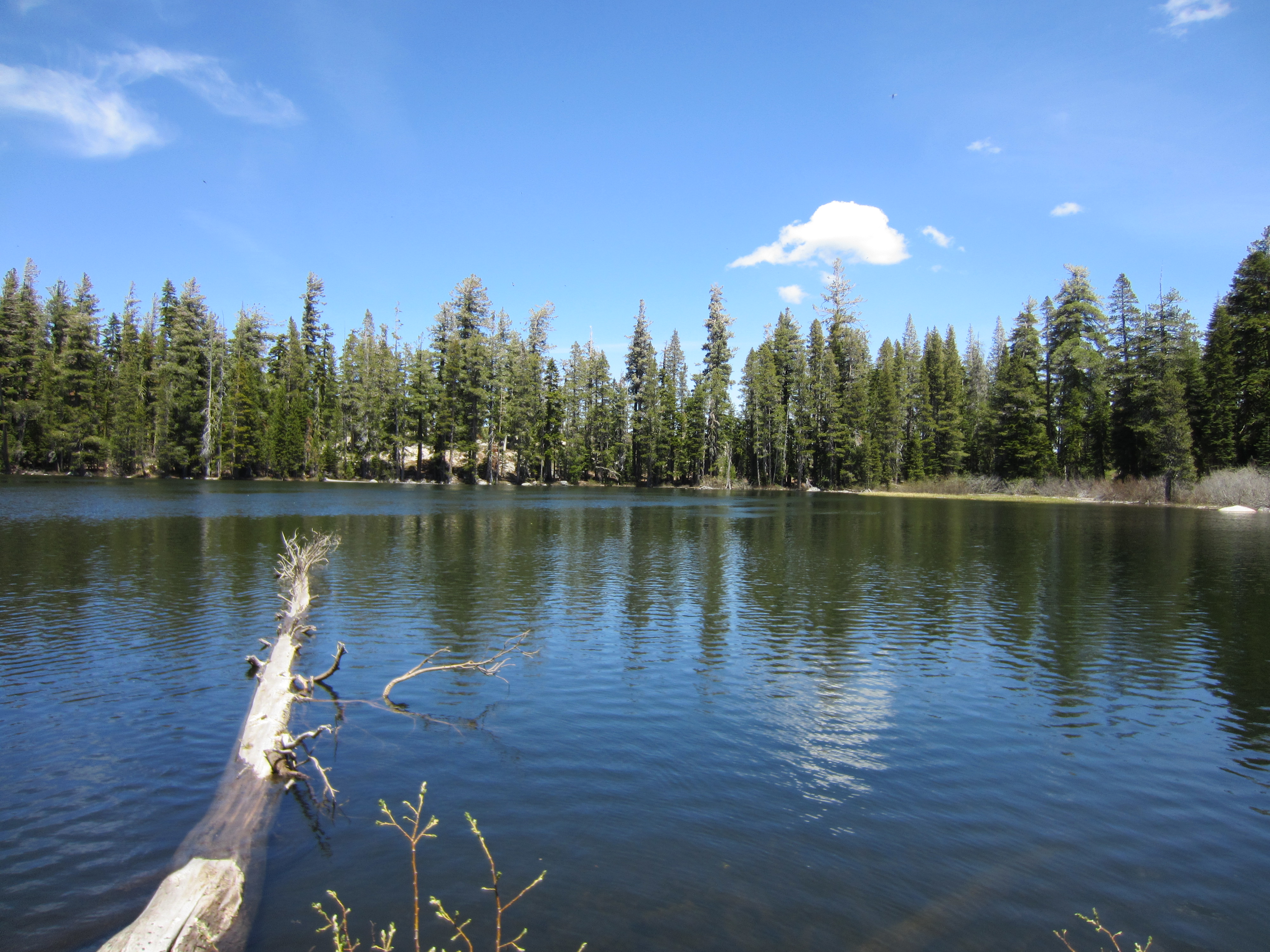
A view of Lake Mary, which isn’t too far from the trail. It is actually right near the trailhead.

The rocky trail, post-beginning switchbacks. After a short distance, the trail winds up to the left, through some trees.

A panoramic shot of the Sierras!!

On this hike, you get the opportunity to be on a section of the Pacific Crest Trail!

On the Mt. Judah Loop Trail!

What I thought was an old, abandoned road, turned out to be the trail!

Somebody adopted a portion of the trail!

Hiking on another portion of the trail.

Castle Peak off in the distance. You can actually hike to the top of Castle Peak as well.

Continuing on the trail.

Another picture of the Sierras.

Craggy rocks looming over the trail.

Looking back at the trail.

A view of Donner Lake from the trail.

Approaching the final segment of the hiking trail!

Almost to the top!!

I made it to the top!!

A view of Castle Peak from the top of Mt. Judah

A view of the Sierras from the top of Mt. Judah.

And starting to make the hike back; because it was a loop trail, I headed off in the other direction. Portions of the trail border the Sugar Bowl Ski Resort, so I saw a few of these ski boundary signs.

A close-up of the ski area boundary sign.

The Mt. Judah Loop Trail sign.

And we’re back on the Pacific Crest Trail!

Looking through the trees.

Hiking along on the trail.

Trail marker.

Another portion of the trail.

Another part of the trail? Or a dusty road? Hmmm…..

A historic ski trail marker dating back to the 1930’s-1940’s.

What better way to end a successful hike than to have a nice drink afterwards! This particular drink was called a “Jack the Ripper”, and you can enjoy it at the Bar of America restaurant in Downtown Truckee.
That concludes our tour today of the Mt. Judah Loop trail. I certainly hope you enjoyed your visit!! I hope that you haven’t been on this trail that you will hike it sometime. The views are great! As always, I welcome your comments and questions.
Cheers,
Rickey
Auto Care and Service
I think other web-site proprietors should take this website as an model, very clean and magnificent user genial style and design, let alone the content. You are an expert in this topic!
rickharris79@hotmail.com
Thank you for your compliments! I’ve been debating on whether I want to keep the theme I’ve had since my blog went online, or go with a totally different theme.